

Lake View Campground
Lake View Campground is composed of 6 campsites including 1 double site, situated in a lodgepole pine overstory on Stanley Lake. All sites are first-come, first-serve. There is a boat ramp near this campsite and Stanley Lake offers excellent swimming, boating, waterskiing, canoeing, kayaking and fishing for rainbow, cutthroat, brook and bull trout. There are several hiking trails in the area…
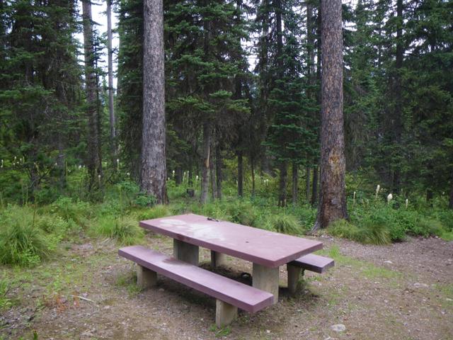
Lake View Picnic Site at Hog Park
The Lakeview Picnic site shares parking with the boat access to Hog Park Reservoir. Parking is available for boat trailers at the ramp. Hog Park Campground is located nearby with 49 sites, including both reservable and first come-first serve sites.
Lake Virginia
Lake Virginia is an 89-acre lake nestled in the narrow southern Appalachian Valley of the Talladega Ranger District, about 5 miles east of Sylacauga. It offers bass, bream, and catfish fishing for the avid angler.
Fish Your National Forests: This site can be accessed by Passenger Car; Fish available include: Bass, Catfish, Panfish; Types of fishing available include: Shore, Non-motorized boat, Fly, Spin, Bait; Boat…
Lake Wedington Recreation Area
Mountain bike trails open. Boat ramp and all other facilities closed.
Lake Wedington is a 102-acre lake located just 13 miles west of Fayetteville, AR on State Hwy 16. During the 1930s, local men employed by the Works Progress Administration (WPA) began building the lake and recreation area and planting trees under the guidance of the Soil Conservation Service. In 1954 the land, facilities and management were passed…
Lake Winfield Scott Campground
Open with no water.Lake Winfield Scott Recreation Area is a destination recreation location situated high in a mountain valley. The recreation area offers year-round recreation opportunities including camping, picnicking, boating, fishing, swimming and hiking centered around the beautiful 18-acre lake. The campground is divided into a north loop and a south loop.
Lake Winona Gravel Bike Loop
This route offers a variety of mountain landscapes and scenic vistas along the eastern edge of the Ouachita National Forest. Riders will encounter mostly intermediate topography with intermittent sections of challenging climbs and rewarding downhill descents. The main road intersections of this route are now signed with a bicycle symbol and designated segment numbers, and the route map is available on Avenza Maps.…
Lakes - Highway 108 Corridor
Whether you are swimming or in a boat, be sure to exercise care and follow water safety rules at all times. Wear an approved life jacket or vest while boating. Never swim alone and don't overestimate your ability. Avoid swimming in streams and rivers during periods of swift flowing spring snowmelt or summer thunderstorms.
Lakes Basin Campground
Lakes Basin Campground is located in the Lakes Basin Recreation Area. Located nine miles southwest of Graeagle, California, this recreation area has special geological features. There is breathtaking scenery and over 20 small lakes nearby, most of which are accessible by hiking trails.
Lakes Basin Group Campground
This group campground is available by reservation only. It is available for tent camping only for groups up to 25 people. It has seasonal water and trash service. It will be available after the county opens Gold Lake Highway and the access road is clear of snow. It usually opens in late May.
There is also a 23 tent and RV campsite campground adjacent to this site. Water, vault toilets, tables, fire…
Lakes Basin Recreation Area
Located nine miles southwest of Graeagle, California, this recreation area has special geological features. There is breathtaking scenery and over 20 small lakes nearby, most of which are accessible by hiking trails. This area provides a multitude of recreational activities including camping, fishing, boating, hunting, mountain biking, horseback riding, picnicking, hiking, backpacking, swimming, windsurfing and…
Lakes End Campground
This primitive campground is located on the north shore of Smith Reservoir and is accessed by boat only. This site is popular with people looking for a remote, off the beaten path camping experience.
Basic facilities such as tables, vault toilets and fire pits are provided. There is no potable water (drinking water). Garbage service is not provided so please keep a pack-in pack-out camp and…
Lakes Trailhead
The Lakes Traihead is located within the Mirror Lake Picnic Area in the Snowy Range. The Lakes trail connects to the Medicine Bow Peak trail. It is not recommended to hike this trail after 3:00 pm due to rapid weather changes. Storms are known to blow in unexpectedly, be prepared! The Lakes trail winds through meadows, sparse Engleman spruce and Limber pine. Hikers will pass beside Mirror Lake and…
Lakes Trailhead
This trailhead provides access to Lakes Trail #1578, which leads to both Cliff and Buckeye Lakes within the Rogue-Umpqua Divide Wilderness. The trails passes through a mixed stand of trees including a madrone forest and young stands of fir, the result…
Lakeshore #120
This rolling hills 1.8 mile interpretive trail takes you around Big Meadow Lake. It allows for peek-a-boo views of the lake with sporadic access. Learn about some of the animals that call this lake their home as you walk.
Lakeshore #126
Gentle walk around Big Meadow Lake.
Lakeshore #504
Designated as a National Scenic Trail this hike offers spectacular views of Sullivan Lake. The trail 4.2 mile trail connects East Sullivan Campground and Noisy Creek Campground. Fairly level but crosses some rock slides. Sturdy…
Lakeshore East Campground
This campground is in close proxmity to Antlers and Sugarloaf boat ramps. Each site has a paved surface area, a picnic table, raised fire ring, and parking spur.
There are two Yurts located at the Lakeshore East campground. What is a Yurt? The Yurt is a modern adaptation of the ancient shelter used by Central Asian nomads for centuries. Though generally classified as a tent, the yurt is much stronger and weather…
Lakeshore Trail/ Inspiration Point Trailhead
Trailhead for the Lakeshore Trail and Inspiration Point Trail. The trail starts out on level ground as the Lakeshore Trail; in about .4 mile the Inspiration Point Trail branches off to the left and climbs steeply to the top of the ridge. The Lakeshore…
Lakeshore Trailhead
Restroom and garbage facilities are available. Day use areas are within walking distance of this trailhead with lake access.
Provides access to: Lakeshore Trail #656 and Lakeshore Express Trail near…
Lakeside Campground
**Please read the Forest Order (linked HERE) for Camping & Campfire Restrictions**
Lakeside Campground is located on the west shore of Prosser Reservoir, 10 minutes north of Truckee, CA. The campground offers single-family campsites. Some campground sites are shaded by pine and fir trees, other sites have full sun and…
Lakeside Campground
Located at the south end of Lake Alva, this campground offers a chance to camp and enjoy lake activities such as swimming, fishing and boating. There are also wildlife and bird watching opportunities here. It is 15 miles to the Mission Mountain Wilderness.
Lakeside Campground
The Lakeside Campground, one of the oldest former National Forest campgrounds in the state of Arizona, has been permanently closed.
LAKESIDE FISH CLEANING STATION CUA DISPERSED
Day Use Area
Lakeside Picnic Site
Picnic site.
Lakeside Ranger District
Lakeside Ranger District
Lakeview Campground
Located on a hill overlooking Parker Canyon Lake, campsites are spread among a stand of oaks and junipers. From the campground it is just a short walk to the lakeshore or a short drive to the boat launch ramp, fishing pier, paved parking areas and paved walkways, all of which are accessible to persons with disabilities.
Parker Canyon Lake and…
Lakeview Campground
< Previous Next >
Lakeview Campground is located near Upper Lake Mary with easy access to the water via the Wood Memorial Trail (0.5 miles) or by car. Many other lakes such as Ashurst Lake,…
Lakeview Campground
3600-foot elevation. 5 sites near the west shore of Hungry Horse Reservoir. Fishing for trout and whitefish in the reservoir; access at Lost Johnny Point boat ramp. Pack it in, pack it out.
Lakeview campsite
Campsite picnic area…